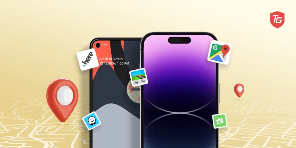
Gone are the days of printed maps and complicated directions. Modern navigation apps utilize GPS, mobile devices, and real-time data to simplify travel and transport. Whether driving, walking, biking or taking public transit, a variety of specialized mapping tools can now guide your way. From transit trip planning to offline navigation to crowdsourced traffic avoidance, the best GPS apps and navigation apps are more powerful and versatile than ever before.
In this blog, we cover the core features and use cases of the top navigation apps. We’ll explore favorites tailored for turn-by-turn guidance, public transit, outdoor recreation, offline use, and more. Read on to determine which of these impressive mapping aids best suits your navigation needs.
1. Google Maps – Places, Navigation & Traffic
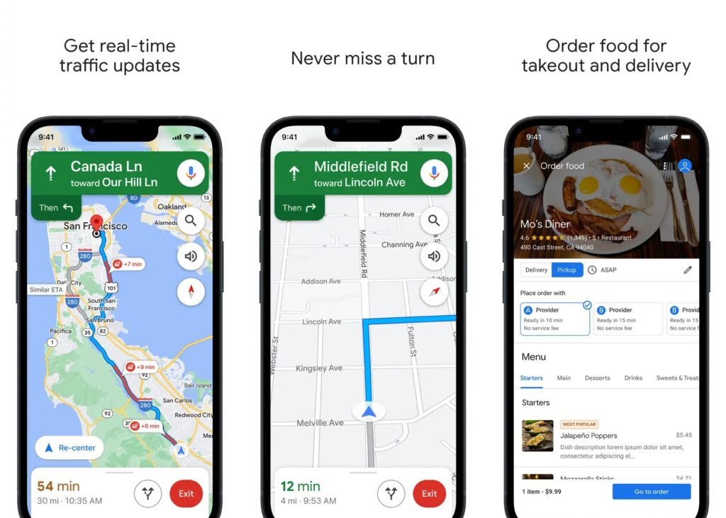
With over 1 billion downloads on Android alone, Google Maps is by far the most popular navigation app for iOS and Android. It offers accurate turn-by-turn GPS navigation for driving, walking, biking and public transportation. Real-time traffic updates based on crowd-sourced data allow Google Maps to optimize routes around accidents, delays, and congestion.
Features like Street View, indoor maps for malls and airports, and details on local businesses help you explore unfamiliar areas. Google Maps is free to use and works offline for basic navigation in areas where you’ve pre-downloaded maps. While not as robust for niche navigation, Google Maps is the best all-around option for daily commuting, travel, and general urban and suburban navigation thanks to the lane-level precision, real-time routing, and comprehensive points of interest.
- Accurate real-time routing
- Public transit directions
- Indoor maps
- Local business info
- Requires internet
- Limited customization
Price: Free
2. CoPilot GPS Navigation – For Car, RV and Truck
CoPilot GPS is a navigation app focused on reliable offline use. It offers turn-by-turn driving directions, voice guidance, and search for addresses, places and contacts all without an internet connection. Highly detailed offline vector maps can be downloaded for free for North America, much of Europe, and parts of South America and Southeast Asia. CoPilot provides navigation guidance and speed limit warnings even when offline.
While offline use is a strength, CoPilot lacks some real-time features of online navigation apps. For users prioritizing navigation in areas with spotty cell coverage, CoPilot GPS stands out through its free offline maps and voice-guided turn-by-turn directions for a range of regions around the world. Even without data, CoPilot provides robust point-to-point routing and speed limit alerts to improve situational awareness on the road.
- Offline navigation and maps
- Voice-guided turn-by-turn directions
- Global map coverage
- Speed limit and speed camera alerts
- Works without cell service
- Requires paid subscription for full features
- Limited real-time traffic updates
- Less frequent map updates than online services
- User interface not as polished as top apps
Pricing: Free App & Premium monthly subscription is $2.99/month & $16.99/year
3. MAPS.ME: Offline Maps for Hiking Trails
With detailed offline maps for over 220 countries, Maps.Me is the leading free offline navigation app for driving and walking. High quality OpenStreetMap data provides turn-by-turn routing, search for addresses and local businesses, and bookmarks for key spots – no cell service required after downloading maps. Maps.Me is especially useful for international travel when you don’t want roaming charges. Real-time traffic and other online map data require connecting to the internet.
However, it lacks some of the public transit and niche outdoor recreation features of other navigation apps. For offline driving and walking navigation anywhere in the world, Maps.Me delivers through its entirely free access to high quality maps covering over 220 countries. With Maps.Me, you get robust point-to-point routing and address search for car trips and walking without needing constant data coverage or racking up roaming fees abroad.
- Free offline maps
- Worldwide coverage
- No real-time routing
- No traffic avoidance
Price: Free
4. OsmAnd – Offline Maps for Travel and Navigation
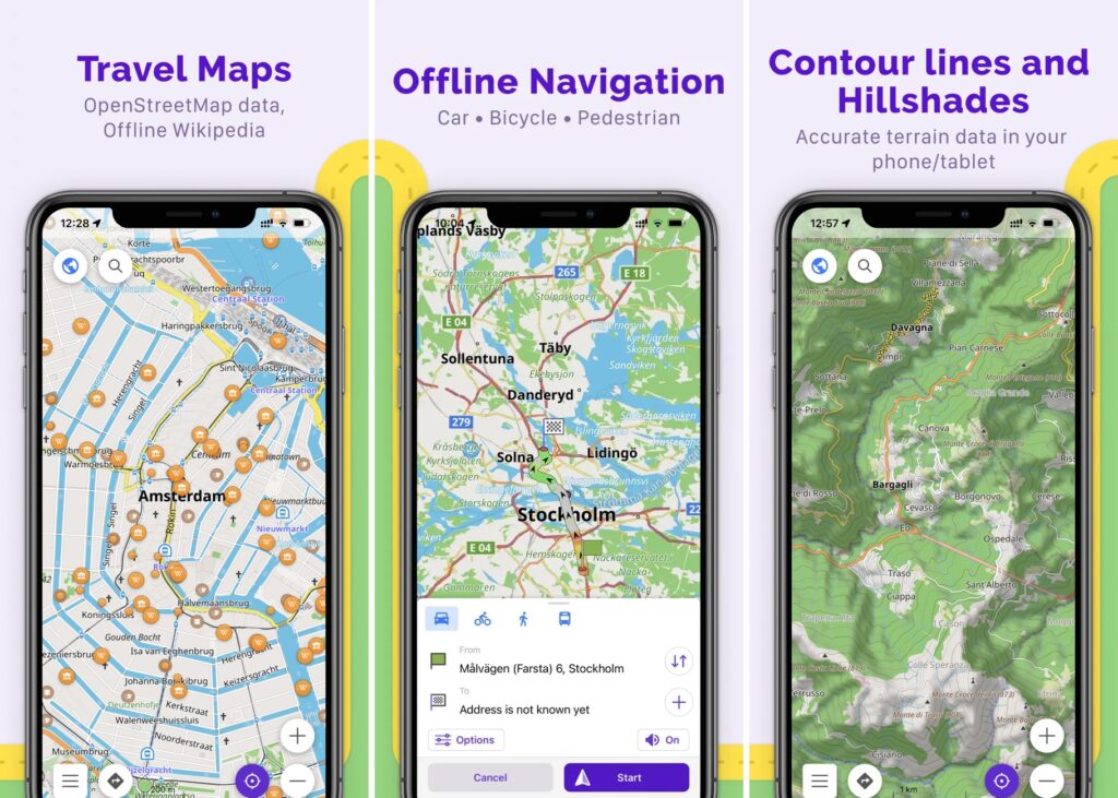
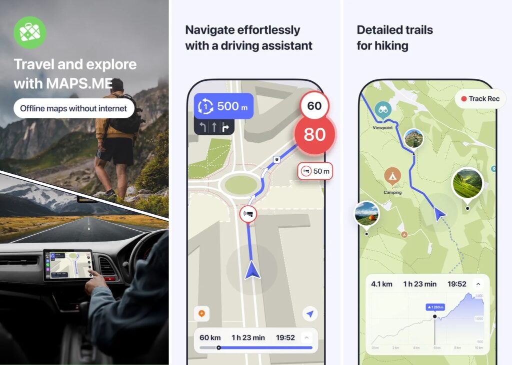
OsmAnd stands out through extreme customization for niche outdoor navigation needs. It offers hyper-detailed hiking, biking, boating and off-road trail maps with global terrain info and contour lines for 3D elevation tracking. OsmAnd’s open-source maps can be downloaded for free offline access anywhere. Waypoints, customizable trip recording, and multiple routing profiles make OsmAnd perfect for backcountry exploration, geocaching, overlanding or recreational activities away from cell coverage.
However, it lacks some of the real-time routing of other apps. For outdoor enthusiasts looking to navigate and track activities off the beaten path, OsmAnd provides unmatched detail and customization through its offline access to hiking trails, backcountry roads, contour topography maps, and recording of telemetry waypoints for post-trip analysis. Its open-source collaborative mapping also suits niche trip planning.
- Customizable
- Offline global maps
- Steep learning curve
- Niche outdoor focus
Price: Free app & paid pro version at $29.99
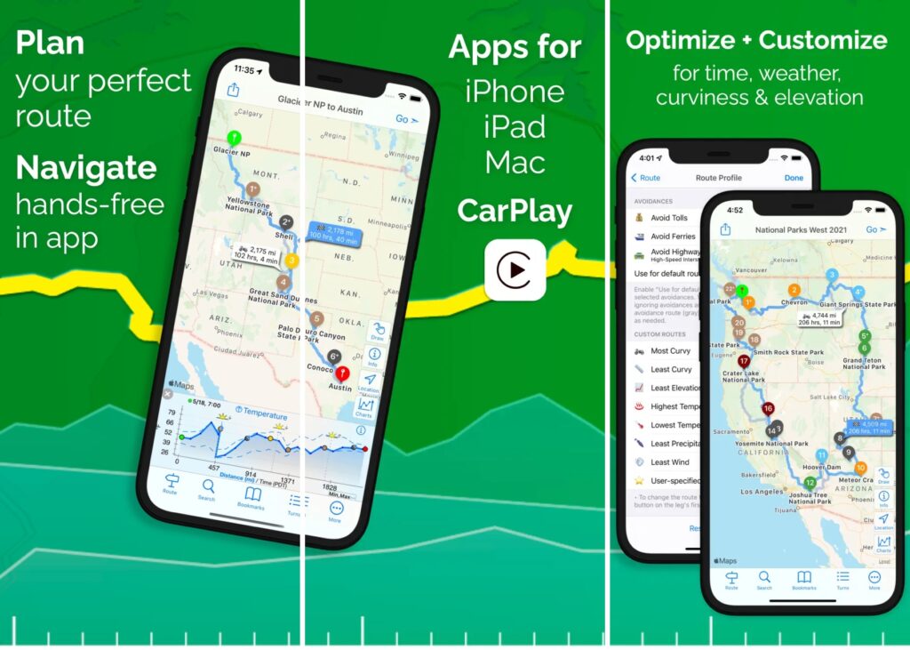
5. Apple Maps – Navigate and Explore the World
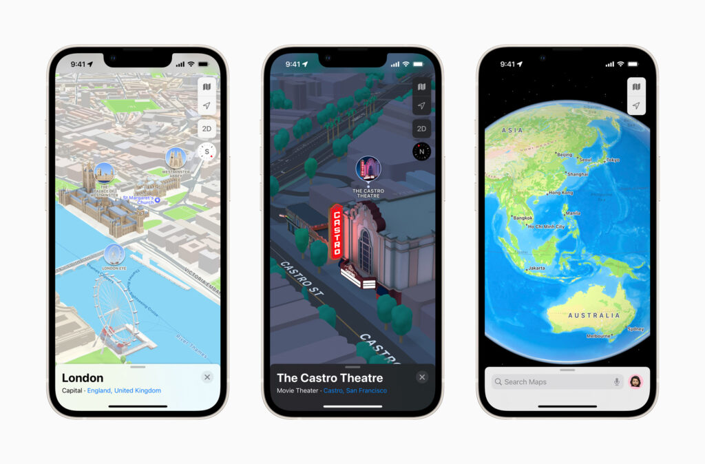
Apple Maps is the proprietary maps and navigation app developed for iPhone and Mac. It uses Apple’s own cartography for turn-by-turn driving, walking and public transit directions. Apple Maps stands out through integration with your iPhone contacts for simplified addresses and calendar appointments. Real-time traffic updates help route around delays automatically. Apple Maps also provides detailed transit directions, schedules and station maps for buses, subway, rail and more.
Siri integration allows hands-free voice guidance to keep your eyes on the road. However, Apple Maps lacks crowdsourced real-time incident reporting. For iPhone users, Apple Maps provides a smoother navigation experience than third-party apps through deep iOS integration. Its clean, intuitive interface combined with real-time traffic routing and public transit features make Apple Maps a convenient go-to for daily travel if you’re already within the Apple ecosystem.
- Native iOS integration
- Real-time traffic & transit
- Offline maps on iOS 17
- Limited customization
- Only for the Apple ecosystem
Price: Free
6. Sygic – Offline Maps, GPS and CarPlay
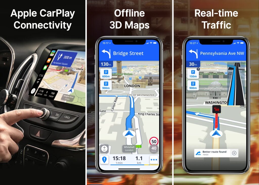
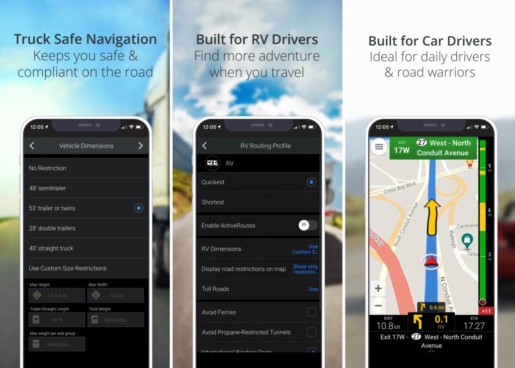
Sygic is a premium navigation app built specifically for drivers. It includes 3D map views, heads-up display, and voice guidance to optimize drives. Sygic leverages crowdsourced reports to warn of traffic, crashes, construction zones, speed traps, and road hazards on your route. Multiple route choices compare by time or fuel efficiency. Specialized GPS helps truck and RV drivers with turn warnings, weight limits, and low bridges.
Sygic offers global offline maps and safety camera alerts to enhance point-to-point navigation. However, it lacks transit navigation features. For drivers looking for an enhanced navigation experience, Sygic provides advanced lane guidance, voice assistance, and crowdsourced hazard warnings to improve road awareness and trip efficiency beyond basic turn-by-turn directions. Its specialized truck and RV features also cater well to professional drivers.
- Advanced driving features
- Offline global maps
- Paid subscription
- No transit navigation
Price: Free use but for premium features it costs $19.99/12-month & $13.99/3-month.
7. Here WeGo – Enjoy the journey
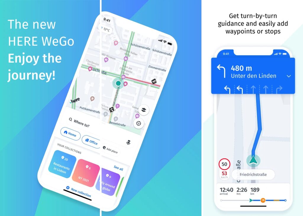
Here WeGo’s specialty is offline navigation, allowing you to pre-download detailed maps to use anywhere without data or roaming charges. It offers car, walking and public transit navigation in over 100 countries. Here WeGo can compare route options to find the fastest, shortest or most fuel efficient journey by car or foot. Real-time traffic updates, turn-by-turn voice guidance, and details on points of interest make Here WeGo a great option for international travel and areas with limited connectivity.
However, it lacks some of the real-time crowdsourced incident reports and niche outdoor recreation mapping of other apps. For driving and walking where cellular data is limited, Here WeGo shines as an offline navigation app with its combination of pre-loaded map data, turn-by-turn voice guidance, and global coverage of over 100 countries.
- Online/offline maps
- Worldwide coverage
- Avoids roaming
- Less real-time data
- Limited offline map customization
Price: Free
8. Moovit – Bus, Train, Subway Live Times
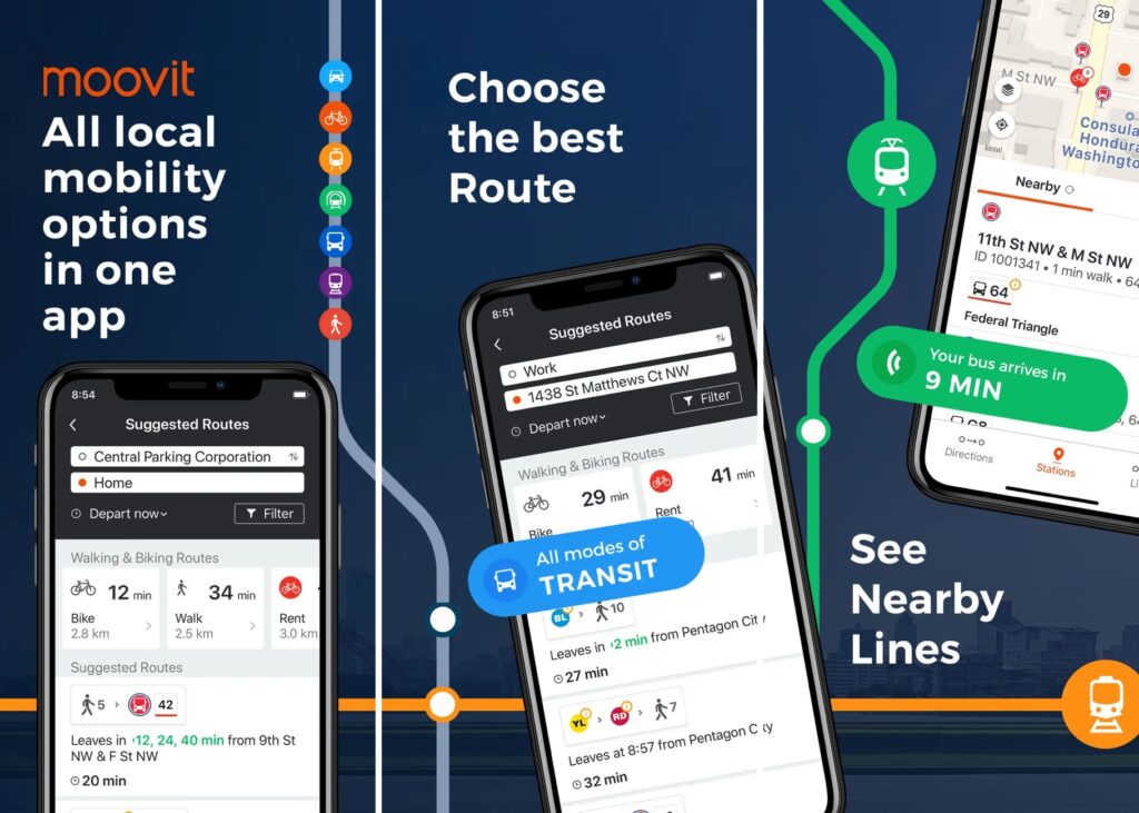
Similar to CityMapper, Moovit focuses specifically on public transit navigation for over 3000 cities globally. It integrates schedules and real-time vehicle tracking across public buses, trains, subways, bikeshares, and rideshares. Moovit offers detailed trip plans with step-by-step directions, live ETAs, and maps showing exactly where transit vehicles are. You can view nearby transit stops and get notified when to disembark. Moovit even reminds you to get off the bus or train with push notifications.
The app works offline for pre-saved areas in 100+ countries. For urban transportation and transit trip planning, Moovit is extremely thorough and convenient thanks to its widespread coverage of cities and transit networks and constant real-time updates on transit vehicle locations. However, driving navigation is not its strength.
- Global transit app
- Real-time vehicle tracking
- Offline capable
- Limited driving features
- Requires user data
Price: Free
9. CityMapper – Live Bus, Metro and Train Times

CityMapper is an urban transportation app designed for public transit in dozens of major metropolitan cities like New York, London, San Francisco, and more. It compiles and compares real-time schedules across all local public transit systems including buses, trains, subways, ferries, bikeshares, and rideshares. CityMapper provides detailed point-by-point directions and walking maps to get you to and from stations smoothly.
You can customize trips to filter by transfers, walking, accessibility, luggage, and more. CityMapper takes the headache out of navigating complex urban transit networks. However, it lacks broader driving and walking navigation features. For public transportation specifically in supported cities, CityMapper is unmatched in its ability to integrate disparate transit options into optimal routes with accurate ETAs and step-by-step guidance from door to door.
- Public transit trip planning
- Real-time ETAs
- Custom filters
- Limited city support
- No driving navigation
Price: Free
10. Waze – Avoid traffic, police, hazards

Acquired by Google in 2013, Waze pioneered crowdsourced navigation by leveraging constant user updates on traffic, accidents, police, hazards and more. With 50 million active monthly users, Waze can instantly route drivers around delays and road closures as they happen. The social component allows you to share drives, meet up with friends along the way, and chat within the app. Waze highlights cheap gas stations as you drive, and offers Carpool lanes to meet riders headed your way.
The real-time, crowdsourced reports and routing make Waze a top pick for daily commuting and drives in congested urban areas. However, Waze lacks specialty outdoor maps and offline navigation. For driving in populated cities, Waze provides the most efficient routes thanks to its unmatched real-time traffic and road condition monitoring from its large user community.
- Crowdsourced traffic updates
- Social features
- Requires internet
- Basic maps
- No walking/transit directions
Price: Free
11. MapQuest – Get Directions and Avoid traffic
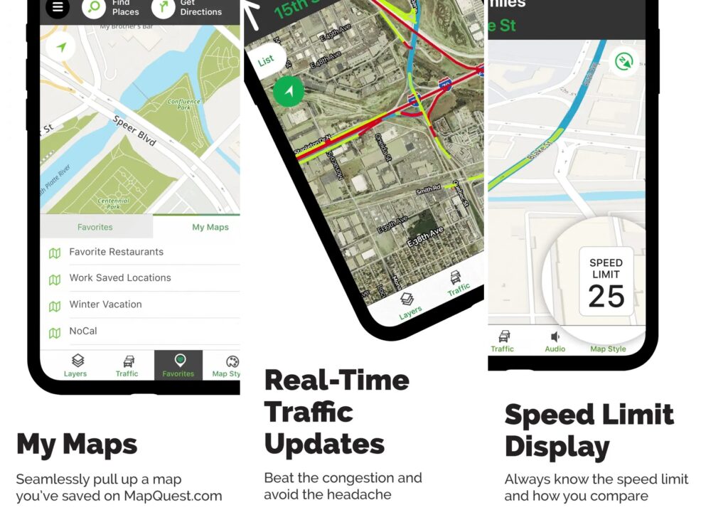
MapQuest is one of the longest running and most recognized web-based mapping services for driving directions and navigation. It provides point-to-point routing optimized by real-time traffic conditions, with voice-guided turn-by-turn navigation available. Users can search for businesses, addresses, and points of interest across its online maps compiled from OpenStreetMap data.
MapQuest offers options to get directions for driving, walking, public transportation, and even routes optimized for EV charging station stops. While not as fully-featured as apps like Google Maps and Waze, MapQuest brings free and straightforward online maps and navigation to desktop and mobile web browsers. However, advanced capabilities like offline navigation, specialty outdoor maps, and crowdsourced incident reporting are limited.
- Free web-based navigation
- Real-time traffic avoidance
- Business search and addresses
- Driving, walking and transit directions
- No offline navigation
- Limited customization
- Less real-time data than Google Maps/Waze
Price: Free
12. InRoute – Route Planner and Road Trip App
InRoute Route Planner is an intelligent navigation app focused specifically on RV and overlanding trip planning. It provides driving directions and route optimization designed around the unique needs of large recreational vehicles. Users input their RV or vehicle’s height, weight, length and other specs, and InRoute customizes turn-by-turn directions accordingly. Offline North American maps are included along with RV-relevant points of interest like campsites, parking, and dumping stations.
InRoute offers at-a-glance views of elevation changes, satellite imagery, and weather forecasts along your planned route. While made with RVers in mind, InRoute can also plan road trips for standard passenger vehicles. However, real-time traffic routing and more robust online map data is lacking compared to mainstream navigation apps.
- Optimized routing for large vehicles
- Customizable directions based on RV/vehicle specs
- Offline North American maps
- Points of interest for RV trips
- Route saving and organization
- Limited global map coverage
- Focused exclusively on pre-trip planning
- No real-time traffic avoidance
Price: Free app, Premium version are One-time $9.99 iOS purchase & One-time $14.99 Android
Conclusion
In closing, today’s GPS Apps and Navigation Apps make finding your way easier than ever thanks to the power of mobile GPS, real-time data, and innovative features. Versatile favorites like Google Maps are ideal one-stop solutions for daily travel and urban navigation. Specialty apps for transit, outdoor exploration, and offline functionality also shine in serving niche needs.
With the range of strengths across the leading navigation tools, travelers can find an app perfectly suited for any journey. So whether you’re a daily commuter, road tripper, or off the grid wanderer, equip yourself with the right mapping companion. Let these advanced navigation aids guide you wherever you need to go with optimal routes, accurate ETAs, and confidence in every direction.
You must need to read: